Image

Remote Sensing

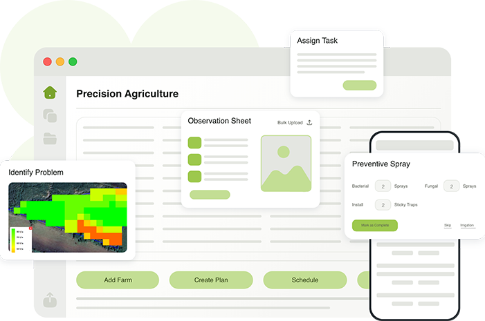
Our Eyes in the Sky, Your Power on the Ground

Precision agriculture begins with vision — and with Anyyl’s Remote Sensing technology, you can see what’s happening in your fields before it’s visible to the human eye.

Using a combination of satellite imagery, drone mapping, and AI-powered analytics, Anyyl transforms raw data into actionable insights. Detect early signs of crop stress, water deficiency, or pest infestation to act fast and protect your yields.

With dynamic maps and automatic alerts, you gain a real-time understanding of your land’s health, allowing you to optimize irrigation, fertilization, and field management. Remote Sensing empowers your team to make proactive decisions — saving time, resources and protecting the environment.

Key Features

1. Satellite Monitoring

Access high-resolution satellite imagery updated weekly to assess vegetation growth, soil conditions and anomalies.

2. Drone Integration

Capture ultra-precise aerial data on crop density, plant stress and irrigation efficiency using drones.

3. Crop Health Index (NDVI, NDRE)

Use vegetation indices to measure chlorophyll, photosynthetic activity and stress zones across large fields.

4. Automated Alerts & Reports

Receive instant notifications for pest outbreaks, drought stress or nutrient imbalances.

5. Decision Support Maps

Generate visual field maps to plan irrigation, fertilizer application and harvest schedules.

Benefits

Detect problems early

act before yield losses occur.

Optimize input use

save water, energy and fertilizers.

Increase yields and consistency

through proactive crop management.

Support sustainability goals

with precision agriculture data.

Empower data-driven farming decisions

from anywhere.
Ready to get started?

Let’s grow the future together